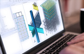
MicroSurvey CAD v15.0.3.1574
MicroSurvey CAD的“現場到完成”過程允許直接從現場工作輕松創建圖紙。無論您使用全站儀、全球導航衛星系統、無人機、掃描儀或攝影測量,我們都可以幫助您將數據轉化為可交付成果。“自動映射”是一個功能,它提供了處理傳入現場工作所需的所有自定義功能。附加的靈活性,由數據庫連接的CAD實體,使現場工作修改快速和無痛。
由于MicroSurvey CAD是一個“一體化”的CAD和計算軟件包,您可以直接從軟件中發布最終或中期結果,而無需導出到另一個CAD程序中完成和打印。
Land Surveying is a competitive industry! We understand that finding ways to increase efficiency and help you save time in the office makes a big difference to the bottom line. MicroSurvey CAD’s “Field to Finish” process allows easy drawing creation directly from fieldwork. Whether you use a total station, GNSS, UAV, scanner or photogrammetry, we can help you turn your data into a deliverable. “AutoMap” is the feature that provides all the customization features you need to process incoming fieldwork. Added flexibility, facilitated by database connected CAD entities, makes fieldwork revisions quick and painless. Since MicroSurvey CAD is an “all in one” CAD and calculations package, you can publish final or interim results directly from your software without exporting to another CAD program for finishing and plotting.

描述:
標簽: cad 測量 軟件 圖紙 衛星分類:資源 > 軟件資源 > 軟件資源:未分類
發布:CGer | 查看: | 發表時間:2020/7/9 14:10:44 | 更新時間:2025/4/5 10:38:46
○ 因利息系統長期被人利用漏洞刷取CG點,目前取消利息功能,作為補償,每個賬號額外一次性補償當前余額的 30% ,充值贈送百分比提高 100% (暫定),請知悉。 ○ 充值或賬號問題請【點擊這里聯系站長】 |
| 常見問題,點擊查詢: | ||
| ●CGer(Cg兒)資源下載幫助 | ||
| ●資源名詞解釋 | ||
| ●注冊/登陸問題 | ||
| ●充值出錯/修改密碼/忘記密碼 | ||
| ●充值贈送系統 | ||
| ●文件解壓出錯/解壓密碼 | ||
| ●Payment with Paypal | ||
| ●哪些資源會被列為付費資源 | ||
| ●為何要充值解鎖 | ||
| ●免責條款 | ||
| ●聯系站長(聯系站長前請先仔細閱讀 免責條款 ,網站只提供資源,不提供軟件安裝等服務!) | ||


