Virtual Surveyor v3.6.1
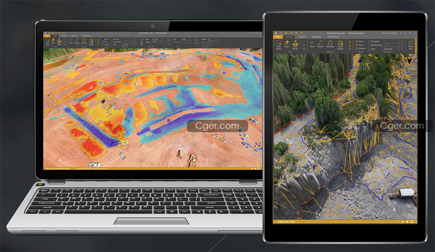
Virtual Surveyor是一個用于分析由航空攝影數據的攝影測量處理得到的地理空間數據和可視化程序。
使用該程序非常簡單,不需要特殊技能。它允許您快速導入正交和高程地圖(DTM),從而為用戶提供一個交互式的三維環境。該程序允許在自動或半自動模式下手動和自動模式下建立三角網格。
該程序有一個方便的功能,可以按計算體積導出數據。程序的結果,取決于任務集,有三角剖分模型、結構線、DEM、3D模型。這些數據可以很容易地導出到CAD。程序中的工作清晰、直觀、簡單。適合廣泛的用戶,因為它允許您快速有效地解決大地測量和礦山測量任務。
Virtual Surveyor 是功能強大的無人機測繪軟件,使用旨在為用戶提供完整的地理空間數據可視化和分析功能,帶來提高的生產力,功能全面而強大,在無人機到CAD模型的過程中,使用Virtual Surveyor軟件來分析、測量體積并繪制斷裂線!從您的無人機數據高效地創建調查,創建測量,表面和輪廓。跟蹤您的Earthworks項目并進行相關的比較工作,創建切割/填充圖并計算體積差異,通過更容易的方法來解釋復雜的地形,利用強大的計算能力來創建您的調查,工作更加輕松,界面直觀簡單。

Virtual Surveyor is a user-friendly software designed for visualization and analysis of geospatial data obtained as a result of photogrammetric processing of aerial photography data. The program has been developed in Belgium since 2015, sold in more than 60 countries. Users: Topcon, Dyno Nobel, Daewoo and others.
Working with the program is quite easy and does not require special skills. It allows you to quickly import an orthomosaic and elevation map (DTM), resulting in an interactive 3D environment for the user. The program allows in automatic or semi-automatic mode to remove artifacts, trees and other objects unnecessary for the calculation; quickly and accurately calculate the volumes of dumps and warehouses of products, select the construction of the sole or upload to a file in * .dxf format previously removed for reliable calculation of volumes; carry out the necessary measurements and calculations; determine the coordinates of objects; create and edit hillshade, contour lines; build a triangulation network in manual and automatic mode. The program has a convenient function for exporting data by calculated volumes. The results of the program, depending on the tasks set, are a triangulation model, structural lines, DEM, 3D model. This data can be easily exported to CAD. The work in the program is clear, intuitive and simple. Suitable for a wide range of users, as it allows you to quickly and efficiently solve geodetic and mine surveying tasks.
描述:
標簽: 地形 數據 測繪 航拍 軟件分類:資源 > 軟件資源 > 軟件資源:未分類
發布:CGer | 查看: | 發表時間:2020/10/23 16:04:34 | 更新時間:2025/4/5 10:45:54
○ 因利息系統長期被人利用漏洞刷取CG點,目前取消利息功能,作為補償,每個賬號額外一次性補償當前余額的 30% ,充值贈送百分比提高 100% (暫定),請知悉。 ○ 充值或賬號問題請【點擊這里聯系站長】 |
| 常見問題,點擊查詢: | ||
| ●CGer(Cg兒)資源下載幫助 | ||
| ●資源名詞解釋 | ||
| ●注冊/登陸問題 | ||
| ●充值出錯/修改密碼/忘記密碼 | ||
| ●充值贈送系統 | ||
| ●文件解壓出錯/解壓密碼 | ||
| ●Payment with Paypal | ||
| ●哪些資源會被列為付費資源 | ||
| ●為何要充值解鎖 | ||
| ●免責條款 | ||
| ●聯系站長(聯系站長前請先仔細閱讀 免責條款 ,網站只提供資源,不提供軟件安裝等服務!) | ||


