ArchiTerraPlus 3
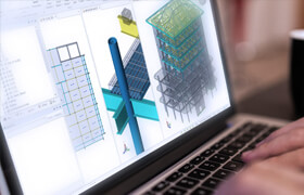
ArchiTerra是ArchiCAD用戶創建和管理3D地形模型的解決方案。這是一個有用的工具,特別是如果您需要處理大型地圖,允許插入其他元素,例如道路、高原、建筑物等。
ArchiTerra的開發和創建是為了解決ArchiCAD用戶的一個特殊問題:三維土地模型的創建和管理。
ArchiTerra通過繪制您自己的站點或從不同類型的文件(如DXF,文本或形狀文件)導入數據來幫助創建地形解決方案,并允許您在2D和3D中工作和可視化形態。
ARCHITERRAPLUS 3.0 版本新聞:
Archicad 26 兼容
新工具:漸變。使用此工具,我們可以輕松檢查任何兩點地形之間的坡度,并在平面圖上以百分比或度數表示。
新工具:溝渠。使用溝渠工具,我們可以定義道路旁邊的溝渠,或者在地形上具有不同剖面的任何地方獨立定義溝渠。
新工具:遏制。分離的路緣工具允許我們在道路元素的任何邊緣定義路緣。路邊輪廓可以使用Archicad的配置文件編輯器進行設計。
更新的用戶界面

ArchiTerra is the solution for ArchiCAD users to create and manage 3D terrain models. It is a useful tool especially if you need to work with large sites, allowing the insertion of other elements such as roads, plateaus, buildings and others.
ArchiTerra was developed and created to solve a particular problem for ArchiCAD users: the creation and management of tridimensional land models.
ArchiTerra helps to create solutions for terrains by drawing your own site or importing data from different types of files, like DXF, Text or Shape files and allows you to work and visualize the morphology in 2D and 3D.
NEWS OF ARCHITERRAPLUS 3.0 VERSION:
Archicad 26 compatibility
New tool: Gradient. With this tool we can easily check the slope between any two points of terrain and indicate it on the floor plan in percentage or degree.
New tool: Ditch. With the Ditch tool we can define the ditch next to the Road or define it independently at any place on the terrain with different profiles.
New tool: Curb. The separated Curb tool allows us to define curbs on any edge of the road element. The curb profile can be designed with Profile editor of Archicad.
Refreshed user interface
描述:
標簽: ArchiCAD 插件 軟件 地形 工具分類:資源 > 軟件資源 > 軟件資源:未分類
發布:CGer | 查看: | 發表時間:2022/11/15 17:12:16 | 更新時間:2025/4/5 11:28:03
○ 因利息系統長期被人利用漏洞刷取CG點,目前取消利息功能,作為補償,每個賬號額外一次性補償當前余額的 30% ,充值贈送百分比提高 100% (暫定),請知悉。 ○ 充值或賬號問題請【點擊這里聯系站長】 |


點擊消耗 10 CG點(約 1.0 元)解鎖 30個通用資源, 12小時內有效!(有效期內不重復扣點)


| 常見問題,點擊查詢: | ||
| ●CGer(Cg兒)資源下載幫助 | ||
| ●資源名詞解釋 | ||
| ●注冊/登陸問題 | ||
| ●充值出錯/修改密碼/忘記密碼 | ||
| ●充值贈送系統 | ||
| ●文件解壓出錯/解壓密碼 | ||
| ●Payment with Paypal | ||
| ●哪些資源會被列為付費資源 | ||
| ●為何要充值解鎖 | ||
| ●免責條款 | ||
| ●聯系站長(聯系站長前請先仔細閱讀 免責條款 ,網站只提供資源,不提供軟件安裝等服務!) | ||